Leica Geosystems Product Categories
Leica Geosystems, headquartered in Switzerland, is a global leader in precision measurement, surveying, and geospatial solutions. With nearly 200 years of innovation, Leica develops high-accuracy instruments, advanced software, and reliable services trusted by professionals worldwide.
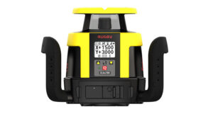
Laser
Leica’s laser tools, including rotating lasers and line lasers, offer reliable and accurate leveling and alignment solutions for construction and interior work.
Total Stations
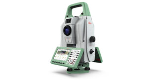
Leica total stations provide precise angle and distance measurements, essential for surveying and construction tasks, ensuring accuracy and efficiency.
GNSS Systems
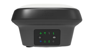
Leica GNSS systems deliver high-precision satellite-based positioning, crucial for surveying and geospatial applications in challenging environments.
GNSS Reference Networks
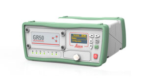
Leica’s GNSS reference networks provide real-time correction data, enhancing the accuracy and reliability of GNSS measurements across large areas.
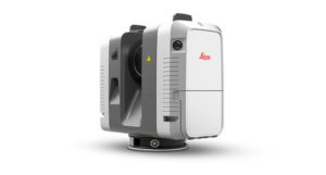
Laser Scanners
Leica laser scanners capture detailed 3D point cloud data, enabling precise documentation and modeling of complex environments.
Laser Tracker Systems
![]()
Leica laser tracker systems offer high-precision measurement solutions for large-scale industrial applications, ensuring accurate alignment and positioning.
Machine Control Systems
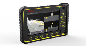
Leica’s machine control systems integrate seamlessly with construction machinery, enhancing productivity and accuracy in earthmoving and grading operations.
TPS & GNSS for Construction
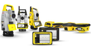
Leica’s TPS and GNSS solutions for construction provide reliable and accurate positioning for layout, as-built documentation, and quality control on construction sites.
Mobile Mapping Systems
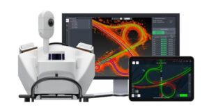
Leica mobile mapping systems enable rapid and efficient data collection for large-scale infrastructure projects, combining LiDAR, imagery, and GNSS technologies.
Airborne Systems
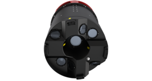
Leica airborne systems offer high-resolution aerial data collection capabilities, essential for topographic mapping and environmental monitoring.
Detection Systems
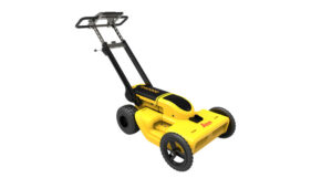
Leica positioning systems provide accurate and reliable positioning solutions for various applications, including geodesy, agriculture, and construction.
Leveling Instruments
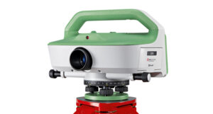
Leica leveling instruments offer precise height measurements, crucial for construction, civil engineering, and geodetic applications.
GIS Data Collection
Leica’s GIS data collection solutions enable efficient and accurate field data capture for geographic information system applications.
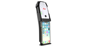
Leica BLK3D
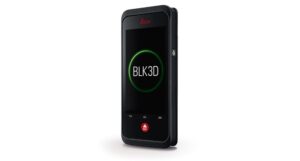
The Leica BLK3D is a real-time, in-picture 3D measurement solution, combining measurement sensors, software, and on-device edge data processing capabilities.
Disto & Lino
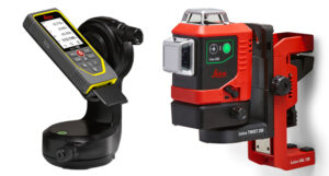
Leica’s Disto and Lino range includes laser distance meters and line lasers, offering precise measurements and alignment solutions for various applications.